Manzini to Mbadlane (MR3) Highway Project (Lot 1)
This report summarizes the successful completion of the MR3 Highway Project (Lot 1), a strategic infrastructure initiative upgrading a critical east-west transport corridor in the Kingdom of Eswatini. This project enhances domestic and regional connectivity, linking key economic zones and facilitating trade.
Project at a Glance
Key Project Metrics
This section provides an interactive overview of the project’s core quantitative data, focusing on the evolution of cost, timeline, and physical scale from the original contract to the final completion.
Contract Cost Analysis
Construction Timeline Analysis
Final Project Scope
The project involved the construction and upgrading of significant infrastructure. The final built scope included the following key deliverables.
12.6 km Dual Carriageway
Asphalt surfaced main highway.
3 Major Interchanges
To manage traffic flow and access.
10 Service Roads
Providing local access (urban & rural).
5 Bridges
Including a prestressed structure.
2 Underpasses
Ensuring local connectivity.
1 Weighbridge Facility
100-ton electronic scale.
1 Reinforced Earth Wall
Mechanically stabilized structure.
2 Major Culverts
For stormwater management.
Project Achievements & Adaptations
The project team successfully navigated complex engineering environments by implementing innovative solutions and robust adaptive strategies.
Enhancement: Pavement Longevity
To ensure the road meets its full design life and withstands increasing traffic loads, the team implemented a comprehensive pavement strengthening program.
Solution Implemented
The asphalt structure was reinforced through:
- Application of a specialized Nano-Tac Fog Spray to seal the surface and prevent moisture ingress.
- Refinement of the asphalt mix design to improve thermal stability.
- Planning of a long-term Bitumen-Rubber Seal to provide a high-performance, weather-resistant wearing course.
Optimization: Infrastructure Alignment
The project footprint was optimized to balance engineering requirements with existing land use and utility corridors.
Solution Implemented
Key engineering adjustments included:
- Constructing a Reinforced Earth Wall to support road alignment within a confined corridor, avoiding the need for extensive land acquisition.
- Relocating the Southern Weighbridge to a geotechnically and spatially optimal location at Km 4+460.
- Redesigning intersections to improve traffic flow without impacting adjacent properties.
Resilience: Schedule Management
The project successfully adapted to external environmental factors, ensuring continued progress despite seasonal challenges.
Solution Implemented
The team employed dynamic scheduling to mitigate the impact of severe weather events (such as Cyclone Eloise). Workflows were reorganized to prioritize critical path activities during favorable weather windows, ensuring the project remained on track for successful delivery.
Major Engineering Features
Beyond the road itself, the project included several complex engineering structures designed for long-term stability, safety, and functionality.
Mechanically Stabilized Earth Wall
A Reinforced Earth Wall was constructed at the Daviot Interchange (Km 6+600) as a cost-effective alternative to land expropriation. This impressive structure reaches a **maximum height of 23 meters** and spans **192 meters in length**, retaining fill and supporting the MR8 Daviot Service Road.
Prestressed Bridge (Bridge 3)
Located at MR3 Km 6+130, this bridge features a **post-tensioned concrete deck** with a **span of 53.7 meters**. This advanced design optimizes structural depth and load-bearing capacity, forming a critical link for interchange service roads.
Southern Weighbridge Facility
A 100-ton electronic, surface-mounted weighbridge was installed at Km 4+460. The facility includes a control room, administrative unit, and boom-gate access, representing a final cost of **E 30,417,594.46**.
Pavement Structure (Main Road)
The main road’s durable pavement structure is built in layers:
- 40mm Asphalt Concrete Surfacing
- 150mm Crushed Stone Base
- 150mm Stabilized Gravel Upper Subbase
- 150mm Stabilized Gravel Lower Subbase
- 300mm Selected Subgrade (in two 150mm layers)
Future Roadmap & Recommendations
The project provided critical insights for future infrastructure works. The following recommendations are key to building on this project’s success and ensuring the longevity of the infrastructure.
-
✔
Ensuring Long-Term Durability: Prioritize the application of the Bitumen-Rubber Seal during the next dry season to maximize pavement life cycle and weather resistance.
-
✔
Comprehensive Pre-Construction Planning: Ensure all land acquisition, Right-of-Way (ROW), and utility relocation tasks are finalized *before* mobilization to streamline construction workflows.
-
✔
Adopt Flexible Design Standards: Embrace adaptive design solutions, such as the successful implementation of Delta blocks, to provide cost-effective and practical engineering alternatives.
-
✔
Advanced Quality Assurance: Continue implementing strict QC protocols for material handling and compaction to maintain the high standards achieved during the rectification phases.
-
✔
Modernize Construction Technology: Integrate updated surveying equipment and digital management tools in future projects to further enhance accuracy and operational efficiency.
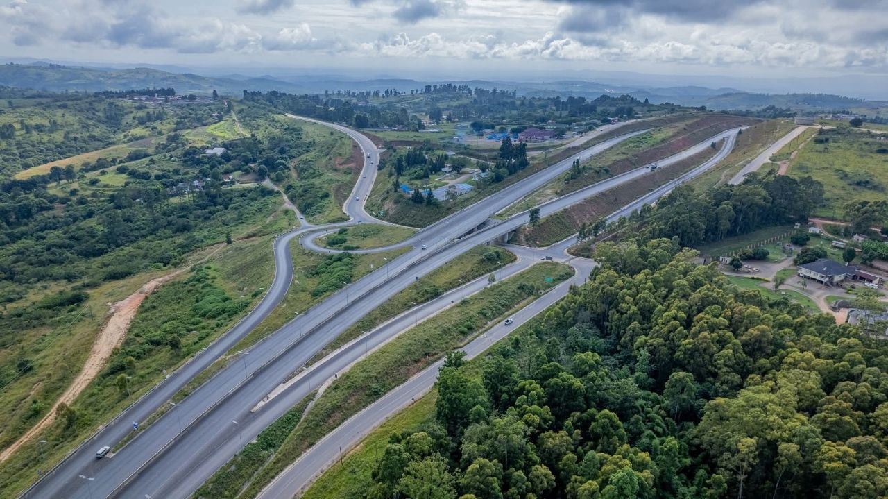
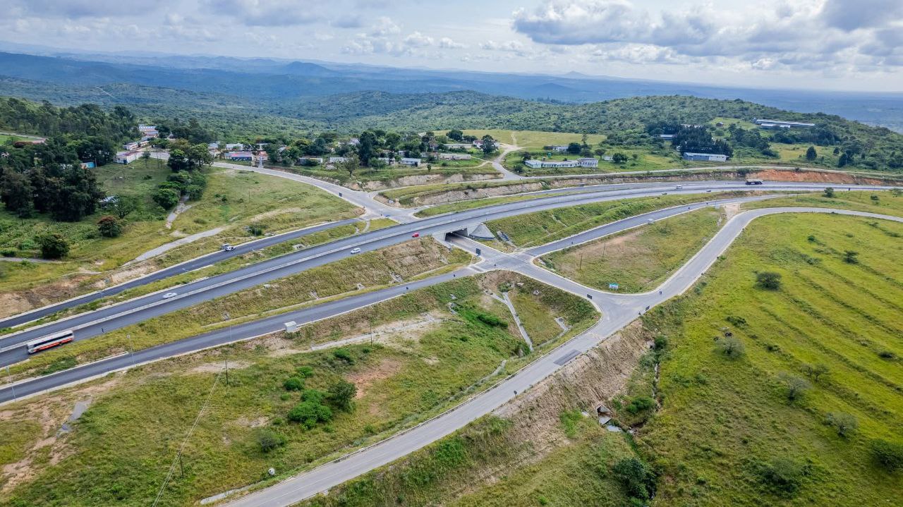
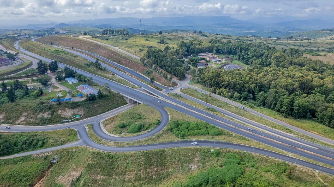
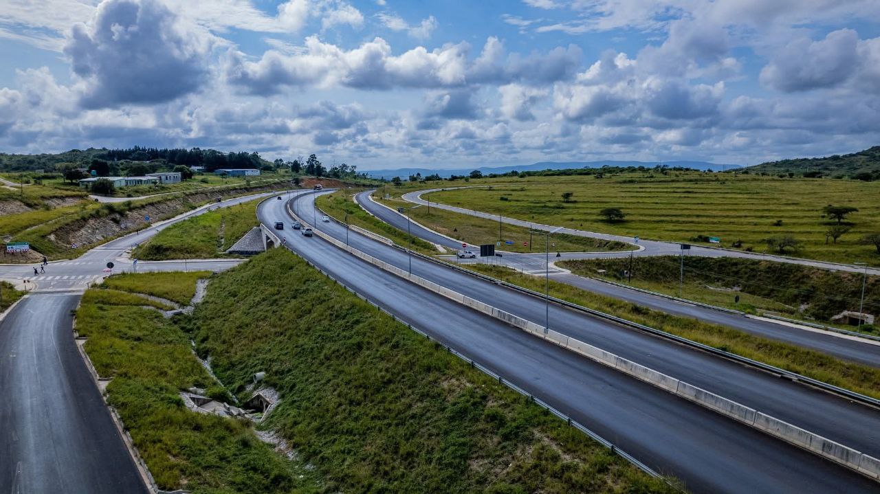
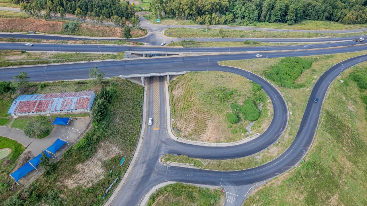
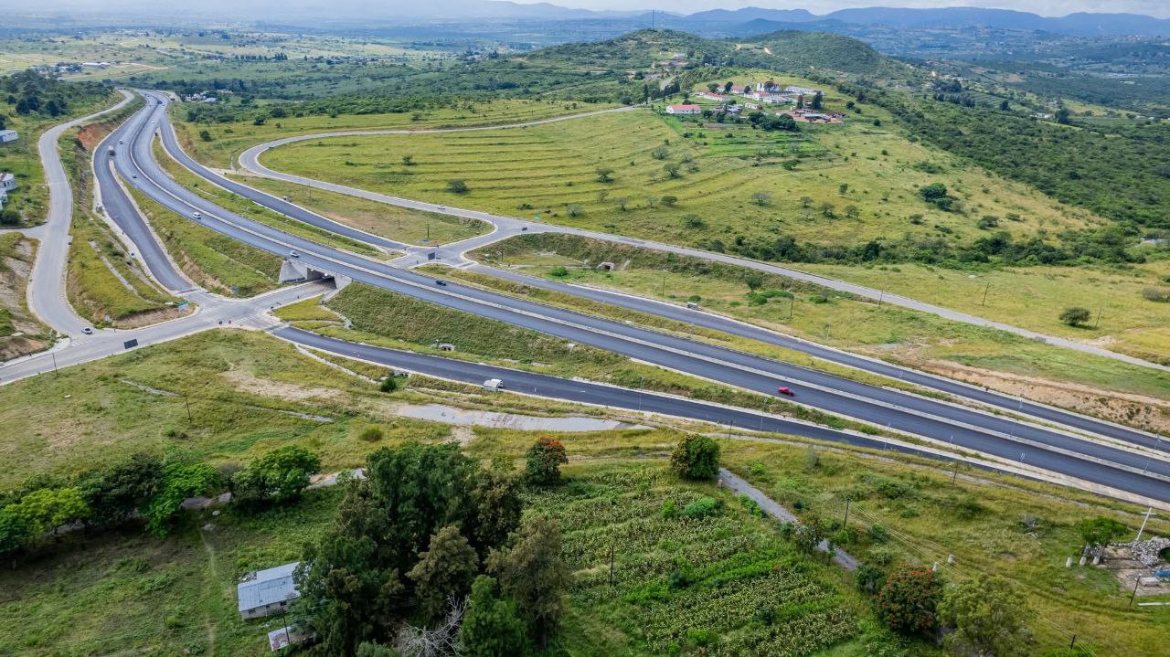
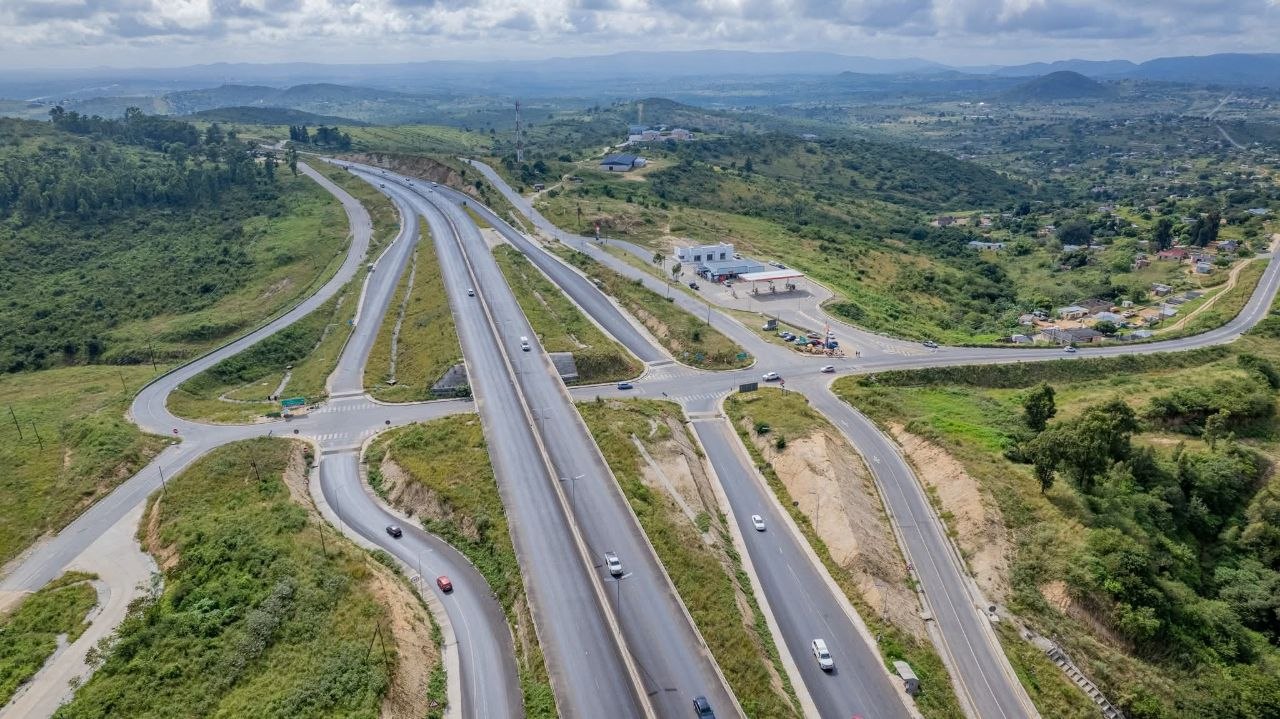
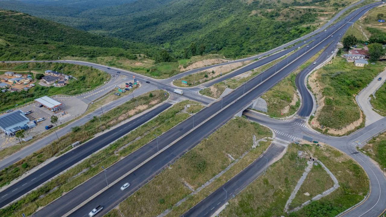
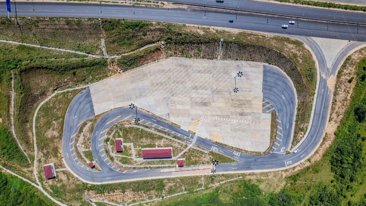
Project Gallery
Visual overview of the completed interchanges, bridge structures, and highway sections. Click any image to enlarge.